|
|
|
| Uyghur Photo Site
|
|
|
Uyghur Photo Site |
Site Manager |
Contact Page |
Information |
In the World |
Kashgar-Atush |
Turpan |
Urumchi-Qaramay |
Qumul-Korla |
Hoten-Aksu |
Ili-Altay |
Kucha |
People |
Culture |
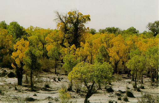
Nature |
Favorite Links |
Uyghur Photo Guest Book
|
|
| Land | The great Altai, Tangri Tagh , and Qara qorum mountain ranges enclose the region on the north, west, and south, respectively; a barren plateau lies to the west. Uyghur Region rivers, including the Tarim, Yarkant, Ili, Manas, and Hotan, rise in the mountains and flow from east to west. The level land, divided by the Tangri Tagh in central Uyghur Region, comprises Dzungaria, a grazing region to the north, and the Tarim basin (Taklimakan), a vast desert to the south. Lop Nur, a largely dried-up salt lake in the Tarim basin, is the site of Chinese nuclear test explosions. Uyghur Region has a dry continental climate with great extremes of winter and summer temperature. |
 |
| Who are the Uyghurs |
Uyghur are the native people of the region, which known as Xinjiang or Xinjiang Uyghur Autonomous Region. China. There are also Uyghur in newly Independent central Asian countries mostly known as Kazakhstan, Uzbekistan, Kyrgyzstan, Turkmenistan and Tajikistan . Uyghur have their homes in Pakistan, Afghanistan, Saudi Arabia, Turkey, Europe and the United States. |
|
| Uyghur Region |
The Uyghur Region environment is fragile: over 90 percent of the land is mountain, hilly, desert, or semi-desert waste (gobi). Only 5 percent of Uyghur Region 's area supports human life so the population pressure on the oases is very high. Some oases have a population density of over 197 people per square kilometer. | 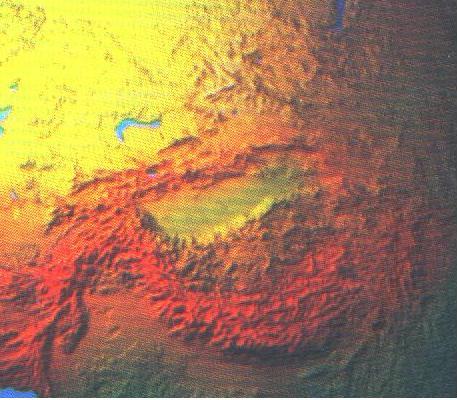
|
| |
Much of Uyghur Region is taken up by the Taklimakan desert, one of the most hostile environments on our planet. There is very little vegetation, and almost no rainfall; sandstorms are very common, and have claimed the lives of countless people. The locals have a very great respect for this `Land of Death'; few travellers in the past have had anything good to say about it. It covers a vast area, through which few roads pass; caravans throughout history have skirted its edges, from one isolated oasis to the next. The climate is harsh; in the summer the daytime temperatures are in the 40's, with temperatures greater than 50 degrees Celsius measured not infrequently in the sub-sealevel basin of Turfan. In winter the temperatures dip below minus 20 degrees. Temperatures soar in the sun, but drop very rapidly at dusk. Sand storms here are very common, and particularly dangerous due to the strength of the winds and the nature of the surface. Unlike the Gobi desert, where there are a relatively large number of oases, and water can be found not too far below the surface, the Taklimakan has much sparser resources. | |
|
|
     |